Recent reports (40)
Comprehensive evergreen guide to Catskill Park hiking covering trail conditions, seasonal weather, camping rules, and hiking challenges. Highlights that trails are steeper and rockier than their elevations suggest, with winter ice on ledges requiring microspikes or crampons; spring and fall bring variable conditions at higher elevations.
adk-balsam-lake,
adk-hunter,
cat-balsam-cap,
cat-blackhead,
cat-cornell,
cat-friday,
cat-indian-head,
cat-kaaterskill-high,
cat-lone,
cat-panther,
cat-peekamoose,
cat-plateau,
cat-rocky,
cat-slide,
cat-sugarloaf,
cat-table,
cat-twin,
cat-west-kill,
cat-windham-high,
cat-wittenberg
coldcrampons-requirederodedexposedicemudrockyscrambleslippery-rootssnowsnowshoes-requiredspikes-requiredsteepthunderstorm-risktrail-degradedwetwet-rock
A backcountry trail guide describing an unofficial route on Kaaterskill High Peak that stays below 3,110 feet, combining scenic views via Paradise Point and Huckleberry Point with exploratory sections through the amphitheater area and hemlock groves.
bushwhackovergrownsteep
A comprehensive peakbagging guide for the Catskill 3500 Club, describing routes, difficulty levels, and strategic pairing of 33 publicly-accessible Catskill peaks above 3,500 ft. The guide covers single peaks, pairs, triplets, and multi-peak challenge routes with no specific trail conditions reported.
adk-balsam-lake,
adk-hunter,
cat-balsam,
cat-balsam-cap,
cat-bearpen,
cat-big-indian,
cat-black-dome,
cat-blackhead,
cat-cornell,
cat-eagle,
cat-fir,
cat-friday,
cat-halcott,
cat-indian-head,
cat-kaaterskill-high,
cat-lone,
cat-north-dome,
cat-panther,
cat-peekamoose,
cat-plateau,
cat-rocky,
cat-rusk,
cat-sherrill,
cat-slide,
cat-sugarloaf,
cat-table,
cat-thomas-cole,
cat-twin,
cat-vly,
cat-west-kill,
cat-windham-high,
cat-wittenberg
Platte Clove Road, a key access route to Eastern Devil's Path and Catskill trailheads including Kaaterskill High Peak, Twin, Sugarloaf, and Indian Head, is closed annually from November through late April or May for winter and road repairs. The page provides current status updates and alternate routing information for accessing these popular hiking areas when the road is closed.
The Escarpment Trail is a 23.9-mile ridgeline thru-hike in the Catskills featuring exposed ledges, wooded ridge walks, and frequent viewpoints. Water is scarce along the route; hikers should filter or carry extra water despite limited sources near Batavia Kill and the trailhead areas. The trail is moderately difficult with much less elevation gain than the Devil's Path, suitable for 2–3 day backpacking trips with multiple bail-out options.
exposedscramblewater-scarce
Multi-year collection of user-submitted Catskill trail conditions reports covering seasonal variations in snow, ice, mud, and water conditions across numerous peaks and routes. Reports span from 2021–2025 and include details on required gear (spikes, snowshoes, crampons) and trail hazards for planning purposes.
adk-balsam-lake,
adk-hunter,
cat-balsam,
cat-balsam-cap,
cat-black-dome,
cat-blackhead,
cat-cornell,
cat-eagle,
cat-friday,
cat-giant-ledge,
cat-halcott,
cat-indian-head,
cat-kaaterskill-high,
cat-north-dome,
cat-panther,
cat-peekamoose,
cat-plateau,
cat-rusk,
cat-sherrill,
cat-slide,
cat-sugarloaf,
cat-thomas-cole,
cat-twin,
cat-west-kill,
cat-windham-high,
cat-wittenberg
blowdownbreakable-crustbug-heavycoldcornice-riskcrampons-requireddeep-snowdryerodedfrozen-groundhard-icehigh-waterhigh-windiceloose-rocklow-visibilitymudmud-deeppostholingrainrime-icerotten-snowscramblescreeslabslide-routeslushsnowsnowshoes-requiredspikes-requiredstream-crossing-difficultthunderstorm-riskverglaswater-availablewater-drywater-scarcewater-stagnantwetwet-rock
This is a curated collection of user-submitted trail condition reports for Catskill peaks spanning from late 2021 through April 2025, covering seasonal conditions including snow, ice, mud, trail quality, water availability, and wildlife/bug activity across multiple routes and elevations.
adk-hunter,
cat-balsam,
cat-balsam-cap,
cat-bearpen,
cat-big-indian,
cat-black-dome,
cat-blackhead,
cat-cornell,
cat-eagle,
cat-fir,
cat-friday,
cat-halcott,
cat-indian-head,
cat-kaaterskill-high,
cat-lone,
cat-north-dome,
cat-panther,
cat-peekamoose,
cat-plateau,
cat-rocky,
cat-rusk,
cat-sherrill,
cat-slide,
cat-sugarloaf,
cat-thomas-cole,
cat-twin,
cat-vly,
cat-west-kill,
cat-windham-high,
cat-wittenberg
blowdownbreakable-crustbug-heavycoldcrampons-requireddeep-snowdryerodedexposedfrozen-groundhard-icehigh-windicelow-visibilitymudmud-deepovergrownparking-fullpostholingrainrime-icerotten-snowslushsnowsnowshoes-requiredspikes-requiredsteepverglaswater-availablewater-drywater-scarcewetwet-rockwhiteout
An evergreen trail guide describing an off-trail bushwhack route from Round Top to Kaaterskill High Peak in the Catskills. The route is entirely untrailed, requires strong backcountry navigation skills, passes through steep terrain with stream crossings, and reportedly has less mud than standard trails to this peak.
bushwhacksteepstream-crossing-difficult
The author and friend Max hiked Roundtop and Kaaterskill High Peak on a cold, sunny winter day, wearing snowshoes throughout most of the hike. The ascent to Roundtop was steep and bushwhacky with good views; they descended via tracks to Kaaterskill High Peak, then took Hurricane Ledge trail down to a snowmobile track. The return on the snowmobile track was unexpectedly difficult with six to twelve inches of crusty snow requiring trail-breaking for three miles.
breakable-crustbushwhackcolddrypostholingsnowsnowshoes-requiredspikes-requiredsteep
Two hikers were injured by falling ice at Kaaterskill Falls on January 11 at approximately 4 PM. One hiker sustained a head injury requiring emergency evacuation; the second was able to walk out. Forest Rangers and multiple rescue agencies responded within minutes and completed the operation at 7:30 PM.
hard-iceicespikes-required
A multi-week fall foliage progression report for the Catskills from mid-September through early November 2022, documenting the timing and location of peak fall colors throughout the season, with conditions ranging from early yellowing to past-peak foliage by late October.
dry
Evergreen trail guide describing seven popular hikes near Woodstock, NY, ranging from short gorge walks and nature preserves to the classic Overlook Mountain Fire Tower hike with hotel ruins. Routes emphasize scenic views, accessibility, and family-friendly terrain in the Catskills.
exposedrockyscramble
A classic out-and-back route via Platte Clove crossing Kaaterskill High Peak summit and descending to Hurricane Ledge. The trail typically features significant mud, inconsistent blazing, and complex route-finding with multiple intersecting old roads and trails.
bushwhackmud
General overview of mud season conditions and trail maintenance best practices on Catskill peaks, noting that Kaaterskill High, West Kill, Hunter, Sugarloaf, and Windham High are particularly prone to muddy and waterlogged sections.
mudwet
An evergreen trail guide to the classic lollipop route up Stissing Mountain to a 90-foot fire tower offering 360° views of the Hudson Valley, Catskills, and Taconics. The hike takes 60–75 minutes through mixed forest with abundant wildlife.
exposedsteep
An evergreen trail guide to the Devil's Path, a 24-mile point-to-point hiking route through the Catskills known for extreme difficulty, relentless elevation gain/loss, and significant winter mountaineering hazards on iced western flanks. The guide covers seasonal closures, water scarcity, trailhead information, and route details for the eastern and western halves.</summary>
<parameter name="confidence">Low
exposedhard-iceicemudrockyscramblesnowshoes-requiredspikes-requiredsteeptrail-closedwater-drywater-scarcewet-rock
Kaaterskill High Peak via Hurricane Ledge is a long lollipop route from Platte Clove featuring wet trails, deep mud on lower slopes, and a steep, tricky ledge climb. The route includes old woods roads, boardwalks, bushwhack sections, and historical sites. Winter ascents of Hurricane Ledge are extremely dangerous due to icy conditions and cliff exposure.</summary>
<parameter name="confidence">Medium
bushwhackerodederosion-severeexposedmudmud-deepsocial-trailssteeptrail-degradedwet
Trail guide to Inspiration Point in Kaaterskill Clove, featuring multiple scenic ledges and lookouts with dramatic cliff views. The main trail from Scutt Road parking is described as mostly easy with relatively flat terrain and some rugged spots, offering excellent vistas of Kaaterskill High Peak and surrounding landscape.
exposedrockyslabtrail-degraded
This guide describes a short, moderate out-and-back route to Dibbles Quarry between Twin and Sugarloaf mountains, featuring an abandoned 1800s bluestone quarry, stream crossings, hemlock groves, and a beaver pond. The main quarry is less than a mile from the trailhead and can be muddy; beyond it lie scenic views, a waterfall, and further exploration areas.
mudstream-crossing-difficultwater-available
Weekly fall foliage condition updates from the Catskills and Adirondacks for the 2025 season, covering late September through early November with observer notes on leaf color progression, weather impacts, and trail conditions at various elevations and locations.
high-waterrainwet
A hiker completes the Catskill 3500 grid (all 35 peaks four times) on August 21, 2022, culminating on Kaaterskill High Peak with friends. The post reflects on a seven-year journey of responsible stewardship, trail maintenance, and deepening appreciation for the Catskills, emphasizing conservation and community over competitive speed.</summary>
<parameter name="confidence">High
A trail guide describing the route to Poets Ledge on Kaaterskill High Peak, a steep hike with excellent scenic views and dramatic ridge-top lookouts. The route includes a road walk, steep evergreen forest, and pitch pine terrain, with no specific dated conditions reported.
exposedsteep
A group of 10 hikers ascended Round Mountain and Kaaterskill High Peak on February 26, 2022, following recent snowfall of 6-8 inches. Snowshoes were required throughout, and icy conditions on the descent required web assistance in one sketchy spot; previous warmups had largely melted the earlier snowpack.
bushwhackicesnowsnowshoes-required
Trail guide for Plateau Mountain via Mink Hollow North, describing a 1.5-mile steep route to the summit and optional extension to Daley Ridge Lookout. The route features rock scrambles, dramatic outcroppings, and a scenic ridge walk through mixed birch and spruce forest.
exposedrockyscramblesteep
Route guide for North Point and North Mountain from Scutt Road trailhead, featuring mixed deciduous and evergreen forests, boardwalks, waterfalls, glacial erratics, Badman's Cave, and multiple ledge viewpoints. The author hiked in foggy/whiteout conditions but primarily describes the route characteristics and features rather than specific weather conditions.
exposedlow-visibilityrockyscramblewhiteout
Route guide for Plateau Mountain via Stony Clove Notch, featuring a steep 1-mile initial climb to Orchard Point lookouts followed by an easy 2.25-mile ridge walk to the summit. Author describes April conditions with residual monorail and mentions seasonal considerations including microspikes on the ridge and exposed sun exposure in summer months.
high-windhotmonorailscramblespikes-requiredsteep
Huckleberry Point is a popular Catskills ledge hike with a tricky stream crossing after rain; the trail is characteristically wet and muddy year-round with beautiful escarpment views. The route is short and easy, taking about 75 minutes to reach the dramatic vista, and features variable terrain with rock ledges and hemlock-laurel forest.
exposedmudrockystream-crossing-difficultwet
The Catskills Fire Tower Challenge is an evergreen guide to seven historic fire towers across the Catskills, offering 360° views from summits otherwise forested. Routes range from easy walks (Upper Esopus) to moderate-to-strenuous hikes (Overlook, Tremper, Hunter), with no specific current conditions reported.
adk-balsam-lake,
adk-hunter,
cat-blackhead,
cat-giant-ledge,
cat-indian-head,
cat-kaaterskill-high,
cat-panther,
cat-peekamoose,
cat-plateau,
cat-rusk,
cat-slide,
cat-table,
cat-west-kill,
cat-wittenberg
A detailed evergreen trail guide describing the Hunter Mountain loop route via Spruceton and Devil's Path trails, including terrain characteristics, muddy sections, boggy areas, and route-finding notes. The author includes a first-person account of a Labor Day sunrise hike with specific observations about trail conditions and landmarks.
blowdownbogbushwhackmudmud-deepscramblesteeptrail-degradedwet
This evergreen trail guide describes the Blackhead & Black Dome loop via Batavia Kill, featuring initial easy terrain along a creek followed by steep, rocky scrambling sections with excellent ledge views. The route combines beautiful forest walking with rugged rock scrambles and is recommended as one of the best Catskill hikes, though it is difficult with exposure and tricky rock sections.
exposedloose-rockrockyscrambleslabsteep
Detailed evergreen route guide for Twin Mountain via the Roaring Kill trailhead, describing an out-and-back hike featuring the scenic Dibbles Quarry and Beaver Pond approach, followed by a technically challenging and exposed ascent on the west side from Pecoy Notch to the summit. The upper section contains dangerous boulder scrambles with significant fall risk and ankle-twisting hazards, though a 2019 reroute mitigates some of the original danger.
exposedloose-rockmudrockyscramblesteepstream-crossing-difficult
This is an evergreen trail guide describing the Dutcher Notch Trail approach to Arizona Mountain from Stork's Nest Road, featuring steep terrain, dramatic boulder formations, and scenic views of the Devil's Path peaks. Comments from hikers include reports of bone-dry conditions in October 2021, ankle-deep wet leaf cover on steep sections in October 2020, and variable weather with clearing skies.
drylow-visibilitymudovergrownrainrockyscrambleslippery-rootssteepwet
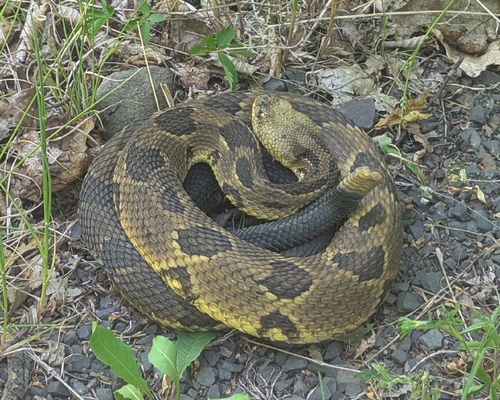
A comprehensive route guide describing a hike from Platte Clove through Plattekill Mountain to Echo Lake, featuring well-marked trail for most of the journey but with a very difficult bushwhack to a scenic lookout on Plattekill's south side. The route includes exposure hazards, thick mountain laurel, rocky terrain, potential rattlesnake encounters, and a steep descent to Echo Lake backcountry campground.
bear-activitybushwhackexposedloose-rockmoose-activityovergrownrockysteep
A moderate, multi-peak route crossing four summits with scenic vistas; features one tricky rock ledge around 2800' and a rock chute below 3750' that can be iced and hazardous in winter. Excellent views from a ledge near Black Dome's summit overlooking the Catskills region.</summary>
<parameter name="confidence">Medium
exposedicerockyscramble
This is a detailed trail guide for ascending Plateau Mountain via Mink Hollow, describing it as one of the steepest routes in the Catskill Park with 1600 feet of elevation gain over 1.5 miles. The route features multiple rock scrambles and ledge systems, wet terrain on the eastern side, and dense blowdown on the plateau. The guide includes seasonal observations and mentions winter conditions with snow cover.
blowdownexposedrockyscramblesteepwater-availablewetwet-rock
A detailed evergreen trail guide for a loop combining Indian Head and Twin mountains via the Devil's Path and Jimmy Dolan Notch. The route features classic Catskill forest, rock scrambles, scenic views, and a treed-in summit on Indian Head with excellent vistas from Twin's lower ledge.
exposedrockyscramblesteep
Evergreen trail guide describing the Kaaterskill High Peak route from Platte Clove with a long muddy approach, multiple junctions, and historic plane wrecks en route. Trail conditions include deep mud in lower sections, lively streams, and variable ice conditions in late November.
bogcrampons-requiredexposedicemudmud-deepovergrownspikes-requiredsteepwater-availablewet
Detailed route guide for the Sugarloaf clockwise loop via Dibbles Quarry and Mink Hollow. The west side descent features loose, shattered boulders and is exceptionally wet with slippery rocks; the author notes that in winter this side becomes icy ("Suicide Mountain") and requires crampons. Spring conditions include boggy ridges with mud patches on the east side approach.
bogbushwhackloose-rockmudovergrownscrambleslippery-rootstrail-degradedwet-rock
First-person account of a challenging loop hike in April over North Dome and Sherrill involving significant bushwhacking through snow, steep ledges with hard ice, and difficult stream crossings. The route included multiple scrambling sections with ledge systems and required navigation through thick brush between peaks.
bear-activitybushwhackhard-icescrambleslabsnowsteepstream-crossing-difficultwet
A route guide describing the Blackhead and Black Dome loop via Lockwood Gap, with detailed descriptions of hiking conditions, notable winter hazards including blue ice blocks and slippery sections requiring microspikes, and scenic viewpoints along the route.
adk-hunter,
cat-black-dome,
cat-blackhead,
cat-indian-head,
cat-kaaterskill-high,
cat-north-dome,
cat-plateau,
cat-sherrill,
cat-sugarloaf,
cat-thomas-cole,
cat-twin,
cat-windham-high
exposedicerockyscramblesnowshoes-requiredspikes-requiredsteepwater-available